• Skip to primary navigation
  • Skip to main content
  • Skip to primary sidebar
  • Skip to footer
  • Facebook
  • Instagram
  • Français
  • English
Simply Savoie Logo

Simply Savoie

Guided walking – snowshoeing – via ferrata in the French Alps with Mark Tennent

  • Home
  • Snowshoe
    • Snowshoe Walking in the Three Valleys
      • Guided Snowshoe Walks Courchevel
      • Guided Snowshoe Walks in Meribel
    • Snowshoe Walking in the Vanoise
    • Guided Snowshoe Weekends in the Vanoise
    • Snowshoe Walking in the Beaufortain
    • Guided Snowshoe Weekend in the Beaufortain
    • Snowshoe Traverse of the Beaufortain
    • Snowshoe Traverse of the Chartreuse
    • Snowshoe Walking in the Haute Maurienne
  • Avalanche Courses
    • Introductory Avalanche Search and Rescue Training Course
    • Intermediate Avalanche Search and Rescue Training Course
    • Avalanche Training Essentials Course
    • Avalanche Awareness Talks
  • Via Ferrata & Rock Climbing
    • Rock Climbing
    • Guided Via Ferrata Weekends
    • Guided Via Ferrata Weeks
    • Via Ferrata in the Hautes-Alpes
    • Via Ferrata holiday in the South of France
  • Walking
    • Centre Based
      • Walking in the Maurienne – Vanoise
      • Walking in the Vanoise
      • Walking in the Beaufortain
      • Walking in the Aravis and Bauges
      • Photography and Walking in the French Alps
    • Trekking
      • Tour of the Vanoise
      • Tour du Mont Blanc
      • The Haute Route – Chamonix to Zermatt
      • The Tour of the Beaufortain
      • Corsica – GR20
      • Tour of the Ecrins
      • Tour of the Queyras
      • 3000m Summits Week
      • The Verdon Gorge & the Haute Provence
  • Custom Guiding
  • About
    • Mark’s Blog
  • Contact

Blog

Visit to Scotland

Visit to Scotland

Scotland holds a special place in my heart. I lived in Glen Coe in the Scottish Highlands up until 2005.

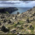
Patricia had never been to Scotland before and I had never been back since leaving Glen Coe in 2005. So finally we made it. After flying into Edinburgh we spent time around Glen Coe, Oban, Fort William. We then took the picturesque ?Road to the Isles? stopping off at the Glenfinnan Memorial and the famous viaduct featured in Harry Potter. The beaches short of Mallaig were as magic as ever, fine white sand and views out to Eigg and Skye. We caught the ferry from the harbour for the crossing to Armadale. Soon we reached Sligachan bringing back memories of days spent on the Cuillin mountains.

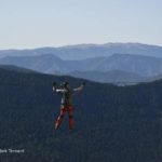
We spent two nights at the Old Inn at the little village of Carbost on the shores of Loch Harport with the Talisker whisky distillery a short walk down the road. We spent a great evening of Scottish music in the bar with four musicians, two of which play in the band Peat Bog Faeires. It was like old times meeting Steve from Talisker Bay who used to run the guesthouse where I was a frequent visitor. We walked in Glen Brittle the starting point for many walks in the Cuillin including the Fairy Pools; sadly in danger of becoming too popular. I asked Steve about this vast increase in visitor numbers and he said one of the huge draws has been the video of Danny MacAskill mountain biking in and on the Cuillin. You can view it here on YouTube.

We visited Dunvegan castle, home to the McLeod clan and the surprising luxuriant gardens. After this cultural experience we took a walk out to the coral beach. We saw seals swimming within metres of the shore and groups of seals basking on a small island in the middle of the loch.

Leaving Skye we visited the iconic Castle Eilan Donan on Loch Duich. The castle has featured in many films including The Highlander, James Bond. I’ve passed by numerous times on my way to and from Skye but until now have never visited inside. It was well worth it.

With our holiday drawing to a close we headed East via Spean Bridge and Laggan before heading southward to Pitlochry on the River Garry. The weather reminded us we were in Scotland, a morning of solid rain before it broke up into heavy showers. We visited Loch Tummel and the village of Kenmore at the head of Loch Tay. We returned to Pitochry via Aberfeldy.

A final day in Edinburgh saw us visit the Queen’s Mile, the Castle perched on it’s volcanic plinth and Arthur’s Seat. We ate dinner in the ?birthplace of Harry Potter?, the cafe where J K Rowling wrote the first of the Harry Potter books as a single mother struggling to make ends meet.

An American Perspective on the Vanoise

The Vanoise is not a name that immediately springs to mind if you live the other side of the Atlantic. The Tour du Mont Blanc and the Haute Route are undoubtedly the hiking / trekking routes that dominate the brochures. This means these two routes and especially the Tour du Mont Blanc (or TMB) have become very crowded during the ?season?.

How would the Tour of the Vanoise compare for a small group of experienced American hikers that I guided on the tour?

Pralognan-la-Vanoise

Pralognan in the Vanoise, French Alps
Pralognan-la-Vanoise nestling below the mountains of the Vanoise

Pralognan-la-Vanoise itself was a refreshing change from the metropolitan, hustle, bustle of Chamonix. Pralognan is literally at the end of the road.

They remarked on how few English voices they heard walking through the centre of the village on the single shopping street. The shops were not dominated by big brand names endeavouring to out-do each other. The other visitors were almost exclusively French and there were no big parties of tourists with eyes glued to cameras or with ?selfie? sticks protruding in front of them.

Pralogan-la-Vanoise
The main street in Pralognan-la-Vanoise

Pralognan-la-Vanoise is an authentic French village experience. Yes, there’s some downhill skiing but first and foremost it’s a village.

On the trail

You will encounter few large, organised groups on the Tour of the Vanoise. This was a dramatic contrast with the ?bucket list?, Tour du Mont Blanc where you’re constantly bumping into other groups. The paths remain in good condition, largely free from the problems of erosion caused by large volumes of trekkers.

Old alpine chalets in the Vanoise
Early morning close to the Refuge de l’Arpont, Vanoise

There are no mountain bikes to share the trail with as they are banned* in the Vanoise National Park. The scenery is simply stunning.

There’s something special about setting off up one valley and then, six days later, returning to the village from another having hardly touched a surfaced road; a refreshing and authentic experience.

There are no options to take a bus to skip a section or to take a cable car or two. Baggage transfer is not an option as there are no road access points along the way. You carry what you need for the entire trip. You carry the essentials and leave behind the trappings of modern life and are happier for it.

There’s no wi-fi at the refuges so you chat with your fellow walkers

Staying high in the mountains

Leaving Pralognan-la-Vanoise at 1400m you don’t drop below this altitude for the whole week. There’s no return to the valley floor. Indeed the lowest point during the trek is 1800m and you spend much of your time above 2000m. You meet like-minded individuals who share the passion for the real mountains uncluttered with man’s ill-considered ?developments?.

Accommodation in mountain refuges

To hike the Tour of the Vanoise you will need to be prepared to stay in mountain refuges (or huts) all with their own character. There’s no possibility of staying in hotels. It’s communal living, sleeping in dormitory style rooms.

The Refuge Peclet-Polset in the Vanoise National Park

The refuges are varied. There are the modern refuges like the Col de la Vanoise, the Refuge de l’Arpont and Peclet-Polset.

Then there’s the traditional Refuge de la Dent Parrachee. Here you rub shoulders with mountaineers heading for the summits and glaciers of the Vanoise.

Refuge de la Dent Parrachee
The Refuge de la Dent Parrachee in the Vanoise.

Creature comforts at La Dent Parrachee are limited but the atmosphere is second to none thanks to the guardian, Franck. Franck presides over the refuge with a humour and a ?joie de vivre? that is infectious.

Finally, there’s the lovely Refuge de l’Aiguille Doran [sadly now closed], set on a grassy shelf above the valley of the Maurienne surrounded by pines and old alpine chalets. The Aiguille Doran is homely and the guardian, Fabienne, is a most wonderful cook and host.

Why take a guide?

… rather than doing it on your own?

Yes, you could ?do it on your own? however here are some reasons why choosing to walk with me may give you an even better holiday.

Local knowledge ? I live in France, and in particular, in Savoie all year round. I also happen to speak fluent French. Over the years I have gained many insights into the area that can give you a far more interesting and enjoyable experience.

The language – If you don’t speak French it’s very difficult or impossible to interact with the local people, be it shepherd’s or other walkers. This interaction enriches your experience. I frequently find myself acting as an interpreter in refuges allowing you to join in conversations with French walkers in refuges or out on the trails.

Route finding – No stress! No need to worry about finding your way. You can relax and let me take care of the route finding allowing you to enjoy your time in the Alps to the maximum.

Choosing the best walks ? whilst you may read about walks in guidebooks or see signs out on the trail they may not be the most suitable for you or the conditions. I can show you places that are not mentioned in guidebooks; especially English language guidebooks.

Culture – avoid committing cultural ?faux pas? from simply not being attuned to local customs and etiquette.

Get off the beaten track – living locally I can help you discover places that you would almost not find out about on your own. Where and when are you most likely to see: ibex, chamois or other wild animals and birds. Where to find alpine flowers and plants like genepy or edelweiss.

Local specialities and produce ? I can introduce you to some of the best local produce and the local markets not the one’s set up to ?trap? the tourists.

Assessing Candidates for the International Mountain Leader Award

At the start of September I joined two other instructors from Plas y Brenin, the UK’s National Mountain Centre, at Samoens in the Haute Savoie for a four day assessment of trainee International Mountain Leaders. The group was split into three groups.

The first day concentrated on looking at protecting clients on steep rocky sections and using fixed equipment like thick ropes or steel cables. I then asked my four candidates to lead me to points I indicated to them on the map. During each candidates navigational ?leg? I asked them to identify flowers, trees and talk about the countryside we were passing through. One of the candidates gave one of their 10 minute talks on an environmental subject of their choice.

The following morning we set off on a three day expedition in the mountains spending two nights in mountain huts. We set off from the Col de Joux Plane above Samoens and headed up on to a narrow ridge protected in places by a cable. After a break on the Pointe d’Angolon we descended a steep grassy ridge watching a herd of sheep and their shepherd below. Soon we were amongst alpine pastures with cows grazing on the late summer grass. The final part of the day saw us pass deep gaping holes in the limestone. The area is famous for one of the biggest cave systems in France, the ?Gouffre Jean-Bernard? with over 23km of passages and reaching a depth of 1602m.

We spent our first night at the Refuge Bostan nestled in a dry valley. The following morning we swapped groups, to ensure that each candidate was seen by another assessor and headed off. After a couple of navigation ?legs? I stopped the group and asked two candidates to set up an ?indirect? belay. I wanted to see them safeguard a short rock step both in descent and ascent. I left the candidates to it until they said they were ready.

Moving off once more we came to the Col de Bostan and the Swiss frontier. Here we looked down to the Rhone valley. Our next objective was the Pas au Taureau, a col, giving access to Combe au Puaires and the Lac de Vogealle. The path became steep and rocky. Part the way up I asked another candidate to take over the leadership of the group. We were now on steep scree with a smattering of fresh snow that had fallen in the last week. The route took a sharp turn left onto scree covered rocks protected by a steel cable that led us close to the top and easier ground. We arrived on the narrow crest of a ridge. It was so narrow that you could sit astride it like a horse (? cheval)! We stopped for lunch in the sunshine looking down on the Lac de Vogealle and the mountains above the Cirque de Sixt-Fer-a-Cheval.

The path down on steep grass led to more scree before climbing once more to the Col de Pointe Droite. Time for a drink and for one candidate to deliver their 10 minute talk to the group. Our onward route continued through tortuous limestone karst requiring concentration. Finally we arrived at the Refuge de Folly. A quick shower and a welcome beer! After dinner I joined the other assessors to compare notes and update the ?matrix? with notes about each candidate. This enabled us to ensure that all points of the syllabus were covered and any remaining ?question marks? about candidates could be addressed on the final day.

The morning started with rain falling steadily but this soon cleared up. The path led down through woods before a traverse brought us to the base of a limestone cliff equipped for rock climbing. Time to eat and drink. The next section of path was protected by a mixture of chains and cables. This gave me the opportunity to test two of the candidates. This done we headed for the car park and a short drive to Samoens.

After lunch I got together for a final meeting with the other assessors. Each candidate was discussed with reference to the ?matrix? and the notes we had made over the last four days. The strong candidates were easy but those whose performance was below or close to the standard were more difficult. Decisions made we called the candidates in individually to give them the result and individual feedback.

It was a very interesting four days for me. I have previously trained and assessed for the Summer and Winter Mountain Leader Awards (UK) and the Single Pitch Award. However this was my first time assessing for a number of years so felt a degree of apprehension. I wanted to ensure that I gave the candidates a fair assessment and to be seen to be doing a ?good job? by Plas y Brenin.

I’m now looking forward to being part of the team delivering IML Winter Training in Le Grand Bornand in January and assessing in Morzine in March.

A Review of the ViewRanger GPS application

If you are looking for a great navigation aid then I can highly recommend ViewRanger. It’s now used by a host of mountain rescue organisations not only in the UK but in France, Switzerland and Norway.

Prior to ViewRanger

I grew up with paper maps and a Silva compass and relied on these for many years in Scotland in the foulest of conditions. So I was a bit of a ?Luddite?. Indeed there’s nothing to ?go wrong? with map and compass. So apart from dropping them, breaking them or them being blown away in a Scottish blizzard they are reliable and you can always carry a spare!

The first bit of ?technical? aid I acquired was a Thommen analogue altimeter in more recent years replaced by a Suunto Vector watch with altimeter. My first GPS was a Garmin Etrex Vista bought for use in Kosovo and Sudan. More recently I bought a Garmin Oregon 650 with a touch screen. The latter was bought with a view to avoid needing to put on reading glasses to look at my map; the joys of age! I’ve found this need to get out the glasses creates an ?inertia? to checking the map, not good!

In the last year or so I’ve gradually become a convert to ViewRanger. ViewRanger is the product of Augmentra Ltd, a company based in the United Kingdom, find out more here. http://www.viewranger.com/en-gb/about-us/company-history

There’s a short ?learning curve? to familiarise yourself with the app on your phone and ViewRanger website. However, in my opinion it’s worth it.

Advantages over a stand-alone GPS

  • You probably already carry your smart-phone with you so using the capacity of the inbuilt GPS means not having to carry another device.
  • Saves on bulk, weight
  • No extra batteries to carry or other types of battery.
  • Large screen – most stand-alone GPS devices designed for walking or hiking are comparatively small compared to smart-phones.
  • Quality of the mapping usually outstrips that found on GPS i.e. Garmin’s French mapping is an adapted version of the IGN and in my view not as good.

Technical

The ViewRanger application works is available for Iphone and Android and the application itself is free to download.

ViewRanger works off-line as it just uses the telephones GPS. You do not need a data connection.

Mapping

ViewRanger has an excellent range of mapping available. The options currently available are:

Premium Mapping

There’s a good range of quality mapping available to buy as ?Premium? mapping. This includes UK Ordnance Survey and French IGN mapping (inc. 1:25 000). You can see what’s available at the ViewRanger Shop. https://shop.ViewRanger.com/

Free mapping

If you don’t need highly detailed professional mapping you can make use of a range of free mapping.

ViewRanger Landscape based on OpenStreetMap, OpenCycleMap, Ski Map, Satellite Imagery, OpenStreetMap, Transport Map

Self-Select Mapping

This allows you to create your own custom areas of ?Premium? mapping by selecting the area you need through ViewRanger’s downloadable Map Chooser tool.

Map Tiles via the App.

For small areas you can download individual map tiles. You can even do this ?on the spot? if you have a mobile data connection and sufficient ?credits? on your ViewRanger account. If you just occasionally find yourself in a new area ?tiles? allow you to just buy what you need for that trip rather than having to buy a complete area.

Worth Being Aware of

Phone Battery Life

On my Iphone I’ve managed a full day out using ViewRanger. It’s worth disabling unnecessary background applications and enabling ?Power Save? options. Reducing screen brightness can also help. For extended trips it’s worth considering a battery top up device.

Weather proofing

If you’re going to use your phone then it needs to be able to withstand whatever weather you encounter. I personally use a LifeProof case for my phone that is completely waterproof and still allows me to operate the phone.

Safety Back Up

Even if I’m using ViewRanger I always carry a paper map in my sac, just in case.

Planning at Home

In the MyViewRanger section of the website you can carry out a range of tasks at home on your desktop, laptop or tablet and then synchronise them with your phone. Amongst other things you can:

  • Create tracks
  • See tracks that you’ve recorded when out on the ground
  • Export routes you create on ViewRanger as .GPX files that you can then import to other ?standalone? GPS devices including Garmin.

?Buddy Beacon?

Share your location with those back home using ?Buddy Beacon? giving them real-time access to your position. A great safety and peace-of-mind feature.

My Verdict

ViewRanger has become my GPS solution of choice with the availability of great mapping.

Snowshoeing in the Haute Maurienne in the French Alps

Well, what can I say! It was a fantastic week for the variety of snowshoeing and absolutely stunning scenery. With a forecast of light winds and sunshine we decided to head for the Col de Mont Cenis.

Col de Mont Cenis

We took the chairlift, ?La Ramasse?, and then put on our snowshoes. The weather was ideal, clear blue skies and not a drop of wind. Quickly leaving the downhill skiers we stopped to take photographs at the Col itself where Hannibal is supposed to have crossed the Alps. The French-Italian border prior to World War II was located here but at the end of the war it was moved to the far side of the lake. We enjoyed a coffee break overlooking the lake admiring the view. On the way back we practised using avalanche transceivers bore having lunch, and a traditional ?Tarte au Beaufort? at the Relais du Col.

Bonneval-sur-Arc

Day two took us from our hotel in Lanslevillard to the village of Bonneval-sur-Arc. Parking up at the end of the village we headed off. The path wended its way through sparse larch and ash alongside the river Arc with deep pools carved into the rock by the power of the water. Soon we could see the hamlet of L’Ecot perched above the river gorge. Only accessible on foot or ski in winter we explored the delightful hamlet, the smell of woodsmoke mingle in the clear, fresh mountain air. We stopped to take innumberable photographs and ate our picnic in front of a closed chalet. We moved on beyond the village to a large flattening in the valley in the direction of the Refuge du Carro perched high up under the Italian frontier. Stopping by a small shepherds hut we spotted ibex above and a lone chamois. An idyllic day in surroundings to take your breath away.

The Chemin de Petit Bonheur

We woke up to snow falling steadily so decided it was a good day to set off from the hotel itself. A short walk had us ?hand-railing? the side of the valley, climbing steadily to the Chapelle St Laurent. A sign indicated the direction for the Refuge du Vallonbrun high above on the southern flanks of the Vanoise. We made fresh tracks past the Col de la Madeleine (not the one known by cyclists) passing by beautiful pine trees to reach the hamlet of le Collet. We carried on in the steadily falling snow along the line of an ancient dyke to eventually reach the Chapelle St Maurice. Here we made for the main bridge across the River Arc. We followed the river bank watching dippers skim along the crystal clear waters of the river. We now picked up the ?Chemin du Petit Bonheur? as we strolled through towering larch trees, the deep carpet of snow creating a wonderful silence. It was therapeutic to be the only people on this magical route with no tracks to indicated the passage of others this day. Rounding the head of a deep cutting gully we started a gentle descent to the alpine chalets at Chantelouvre and then past the Chapelle St Etienne. Our snowshoe walk ended back in the village of Lanslevillard.

The Monolithe

Today the wind was blowing so the plan was to head for the forests near the villages of Sollieres and Sardieres. The snow-covered road wound up from the valley bottom and the River Arc. Parking at the start of the cross-country ski tracks we gained a path threading its way through the pine woods. Decision time! It was left and we worked our way up through the forest in the deep fresh snow that had fallen overnight. Along the onward track wood sculptures draped in snow appeared surreal in the surroundings. A sharp change in direction and on to a narrower path gave us tantalising views of the Monolithe, a 90 metre high pinnacle of rock rising out of the woods. A ?belvedere? gave us even in better views of this dramatic geological oddity. Descending now in soft powder snow, absorbing each step like going down a summer sand dune.

Averole

A deep valley starts just outside the village of Bessans and opposite La Bessannaise Nordic ski centre. Leaving the cross-country ski pistes behind the mountains soon impose themselves. High above the hanging glacier below the summit of the Pointe de Charbonnel (3752m). A hanging glacier broods, damocles like, high above. Huge slopes plunge valley-wards and the Torrent d’Averole. On the left somewhat gentler slopes, covered, low-down by larch provide a home to chamois sheltering from winter’s grip. Enormous avalanche tips reach down to the river like lava flows, the result of earlier rises in temperature purging the slopes. Soon our path started to gain height gently and soon we came to the hamlet of Vincendieres, deserted, frozen in time. Onward, impercetibly gaining height, with beyond the imposing summit of La Bessannaise (3592m) guarding the Italian frontier. The hamlet of Averole revealed itself with it’s church spire standing sentinel in this wild, remote valley like a lighthouse. It was yet another unforgettable day. We only crossed the paths of three people all day. So, if you are yearning for space, peace and solitude come here in winter!

Bramans

Our final day and we made a short drive down the valley. The road took us through the village of Termignon and on to the village of Bramans. In winter the road leading to the Vallee d’Ambin is barred not long after the village. The path ascended in zig-zags through larch and spruce to a small plateau area with views across the valley to the Grand Parrachee and the Vanoise. Across a small valley we could make out the Chapelle d’Extravache.

  • « Go to Previous Page
  • Page 1
  • Interim pages omitted …
  • Page 35
  • Page 36
  • Page 37
  • Page 38
  • Go to Next Page »

Primary Sidebar

Mark

Mark - Simply Savoie
Mark

Footer

Useful Links

  • FAQs
  • Weather
  • Photo Gallery
  • Privacy Policy
  • Terms and Conditions of Booking

Latest Articles

Stone Stacking in the mountains

Cairns A cairn is a man-made pile (or stack) of stones. The word cairn comes … [Read More...] about Stone Stacking in the mountains

Autumn via ferrata trip to the South of France

Finally the time came to run my first via ferrata tour in the South of France! Saturday, 28th … [Read More...] about Autumn via ferrata trip to the South of France

Follow Simply Savoie on:

  • Facebook
  • Instagram
  • YouTube