
The Tour du Mont Blanc appears in the “Top 50 Treks of the World”. The TMB goes through three countries, France, Italy and Switzerland.
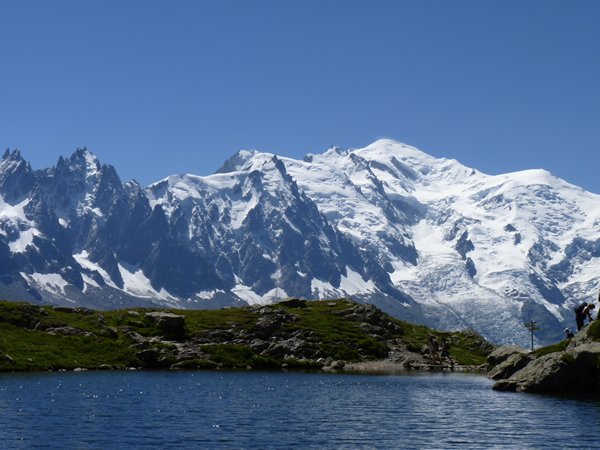
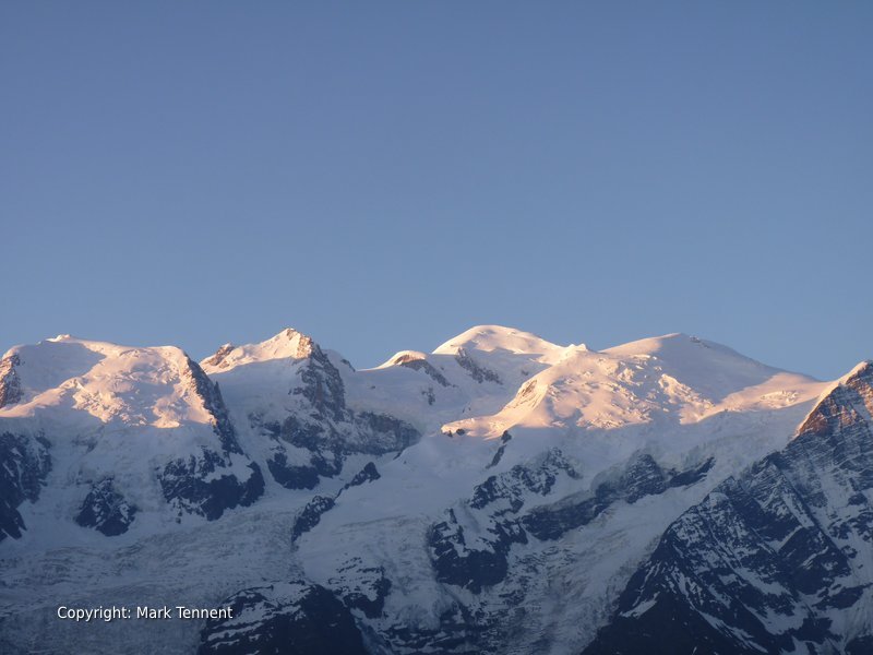
View towards Mont Blanc from Chamonix in the French Alps
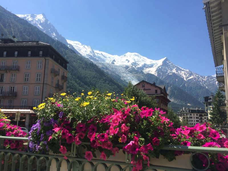
The usual starting point for the TMB is the town of Chamonix-Mont Blanc. Chamonix is considered to be the “World Capital” of alpine mountaineering.
The route passes through eight valleys on its way: the vallee de l’Arve (often known as the Chamonix valley), the val Montjoie, the vallee des Glaciers (Chapieux and Les Mottets), the val Veny, the val Ferret (Italian), the val Ferret (Switzerland), the val d’Arpette and the valley du Trient (Switzerland).
There are numerous variations of the TMB some of which are much more physically demanding. Part of the TMB follows the the GR5 (that starts at the North Sea and finishes at the Mediterranean). Part of the route is also used to join the Haute Route going from Chamonix to Zermatt in Switerland.
The highest points on the trek are the col des Fours (2665m) and the fenetre d’Arpette (which is one of the most difficult and challenging options)
Mont Blanc is the highest mountain in Western Europe at 4808m. It gives its name to the Mont Blanc massif which straddles the French-Italian border.
Our Tour du Mont Blanc takes in the “Highlights” of the TMB. This allows you to fit the tour into a one week schedule.
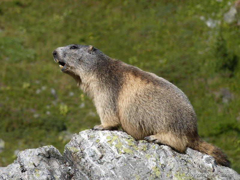
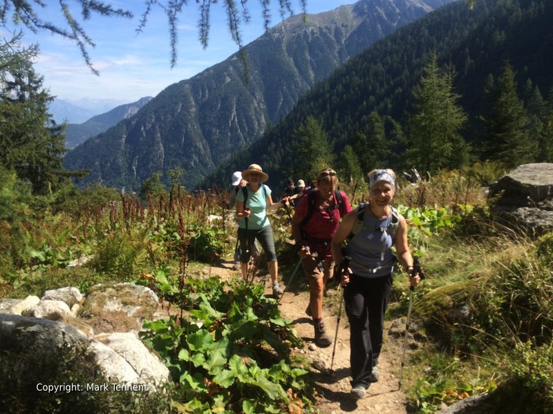
The footpaths thread their way through lush alpine pastures (alpages) ablaze with a magical carpet of alpine flowers with panoramic views second to none.
History
The first Tour du Mont Blanc was probably completed by Horace-Benedict de Saussure, a Swiss naturalist who undertook a dozen trips to Chamonix to look at the Mont Blanc massif.
The first ascent was by Jacques Balmat and Doctor Michel Paccard on the 8th of August 1786.
Chamonix – Chapieux
Duration : 7h 00
Ascent:1 220m
Transfer to Notre Dame de la Gorge. The village had a church from the 13th to the 19th century. The route leaves from the village on a nature path. From the chapel our route climbs the right bank of the river on a slabby track dating from Roman times. We reach the hamlet of Nant Borrant (1460m) situated with a view dominated by the Domes de Miage and the Glacier de Tre-la-Tete and Mont Tendu. Crossing a small plateau with a large tumulus we reach a short but steep slope leading to the col du Bonhomme (2 329 m). At the col there is a small shelter; and to the left an outcrop with two heads knows at the “Bonhomme” and the “Bonne Femme”. The route continues traversing to gain the col de la Croix du Bonhomme (2 479 m) and then on to the refuge de la Croix du Bonhomme. A descent takes us to Chapieux passing chalets d’alpages. Transfer to overnight accommodation. Luggage transfer.
Day 3
Chapieux – Courmayeur
Duration : 6 h
Ascent: 962m
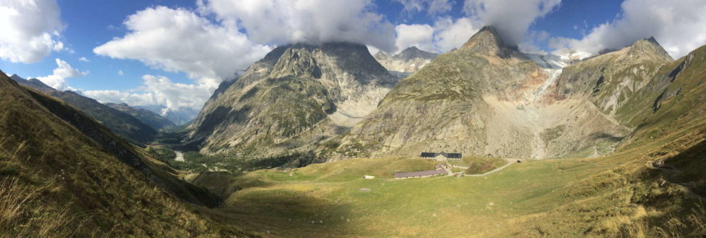
Starting from the hamlet of Chapieux; a name derived from the Savoyard patois word for a place to store ploughs. We go up the valley passing the hamlet of Seloge and then a short time later reaching the Ville des Glaciers (1789m); a grouping of shepherd’s buildings facing the l’Aiguille des Glaciers. Crossing the stream and climbing gently parallel to the river we arrive at the Chalets des Mottets (1870m). From here the track starts climbing in a series of bends gaining height rapidly before the slope eases off and finally we reach the Col de la Seigne (2516m) and the frontier with Italy. The col also marks the watershed between the Mediterranean and the Adriatic. Time for a well-earned stop. A chance to take in the breath-taking southern flanks of Mont Blanc with its many satellite peaks. In Italy now we descend slopes A transfer by local bus now takes us to our overnight accommodation in Courmayeur. Time to enjoy an Italian “gelati”!
Day 4
Courmayeur – Champex
Duration: 5 h 30m
Ascent: 768m
Leaving from Arp-Nouva Desot (1769m) we cross a mountain stream before a path through the pretty alpine pastures leads us to the Refugio Elena (2062m). From the refuge a good path through the alpages, then short zig-zags climb towards some farms “d’alpage” (2 264m). Continuing on we reach the Grand Col Ferret (2 537m) and the Swiss frontier and the canton of Valais. Descending we pass close to the la Chaudiere and then cross a number of couloirs before reaching the Chalet de la Peula (2071m). Continuing the descent we reach the valley and Ferret and thence the pretty village of La Fouly. A transfer to the village of Champex. Overnight in Champex.
Day 5
Champex – Col de la Forclaz
Duration: 5 h 30m ( 6 – 7 h)
Ascent: 531m (1200m)
Our route climbs gently through larches in the Six-Fours valley, then a zig-zag climb to reach the top edge of the forest. The route continues traversing now to reach the “Fermes de Bovine” (1987m) with views of Martigny and the Rhone valley. Climbing on through alpine pastures to the Collet Portalo (2049m) before a rapid descent with views to the col de la Forclaz through the larch trees. A short descent later leads us to the hamlet of Trient and our overnight stay. Depending on the weather and the group there may be a possibility of taking the more demanding route via the Fenetre d’Arpette.
Day 6
Trient – Le Tour
Duration: 881m
Ascent: 6 h 30 min
Leaving Trient the path climbs through the pastures until reaching the shepherd’s buildings at “Herbageres” (2033m). Continuing to climb we reach the col de Balme (2191m) and a view down the Chamonix Valley. On to the summit of the Posettes (2 201 m) with a superb panorama and then a route descending through the forest and the pungent smell of the pine woods leading to Trelechamp ( 1 417 m). Overnight in Argentiere.
Day 7
Le Tour – Chamonix
Duration: 6 h 30
Ascent: 715m
The classic panoramic view of the Mont-Blanc massif and Mont Blanc itself. Continual views of the mountains dominating the Chamonix Valley leads us eventually to the lacs des Cheserys (2169m). A mountaineers paradise. Descent to la Flegere and a cable car to Chamonix. Overnight in the Chamonix valley.
Fees
The price indicated is for the group.
1 – 2 people: Euro 1500
3 – 5 people: Euro 1800
6 – 8 people: Euro 2400