Highlights

Take your next step …
Here’s a revised version optimized for SEO and readability:
Tour of the Vanoise: A 6-Day Guided Hut-to-Hut Hiking Adventure
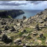
Embark on a breathtaking 6-day guided hut-to-hut hiking tour through the Vanoise Mountains, starting and ending in the picturesque alpine village of Pralognan-la-Vanoise—commonly known as Pralognan.
Your Base in Pralognan
Pralognan serves as one of the key gateways to the Vanoise National Park, offering access to unspoiled alpine landscapes.
On your first and last nights, enjoy the warm hospitality of the Hotel Grand Bec*, a charming, family-run hotel in the heart of the village. Relax in the hotel’s outdoor heated pool, surrounded by stunning mountain peaks.
👉 Read more about this trip on Thirdeyemom’s Blog, featuring stunning photography of the region.
Tour of the Vanoise – The Route
Once we leave Pralognan, our trail remains high in the mountains, rarely descending below 1,700 meters until our final return to the valley. Nearly the entire journey unfolds within the protected landscapes of Vanoise National Park, far removed from modern roads and development.
A highlight of the trek is the Glacier de la Vanoise, a spectacular companion along much of our route. On the first two days, we pass beneath the park’s highest peak, the Grand Casse (3,855 m), with cascading glacial streams carving their way through the valleys below.
Enjoy panoramic views stretching across the Italian border and southward toward the dramatic summits of Écrins National Park, including the Barre des Écrins and La Meije. The highest point of the trek is the Col de la Chavière (2,796 m), marking our transition from the Maurienne Valley back toward the Refuge Péclet-Polset.
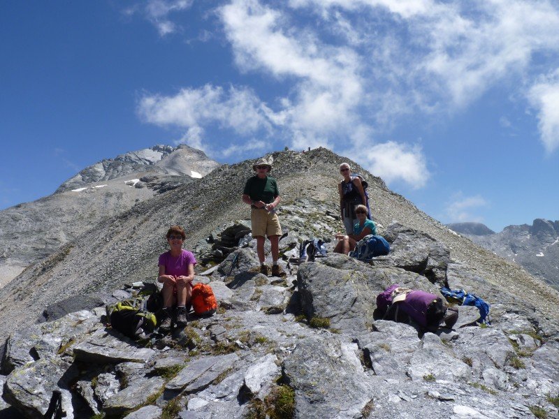
For adventurous hikers, a possible ascent of Col de la Masse (2,923 m) may be an option, depending on weather conditions and group ability.
Authentic Mountain Refuges
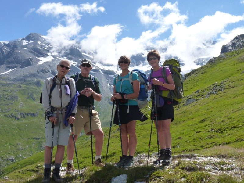
Each night, we stay in authentic alpine refuges (mountain huts), where local hut guardians provide hearty meals and warm hospitality. Staying in a refuge offers a unique experience—you’ll witness breathtaking sunsets, starlit skies, and the camaraderie of fellow trekkers and mountaineers.
Wildlife & Alpine Flora
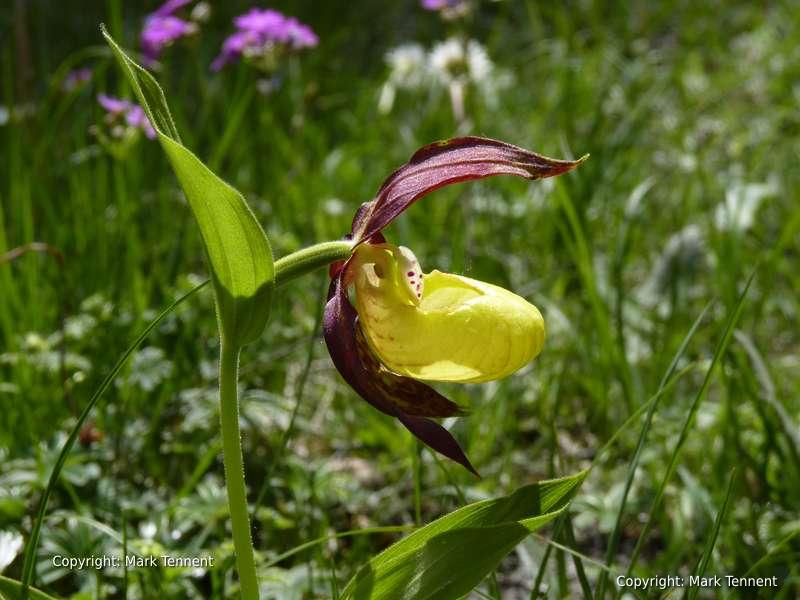
Early in the season, the Vanoise National Park bursts into a vibrant display of wildflowers, including edelweiss, gentians, and génépy, painting the alpine meadows with vivid colors.
The park is home to a variety of iconic wildlife, including:
🦅 Bearded vultures (Lammergaiers) – With wingspans of nearly 2.8 meters, these majestic birds soar high above.
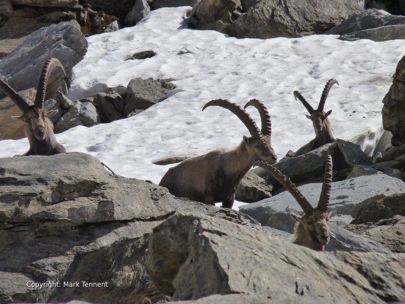
🦌 Ibex – Once nearly extinct in France, these graceful mountain goats are now thriving, often spotted in rocky terrain.
🐐 Chamois – More elusive but equally captivating, these agile creatures navigate the steep cliffs with ease.
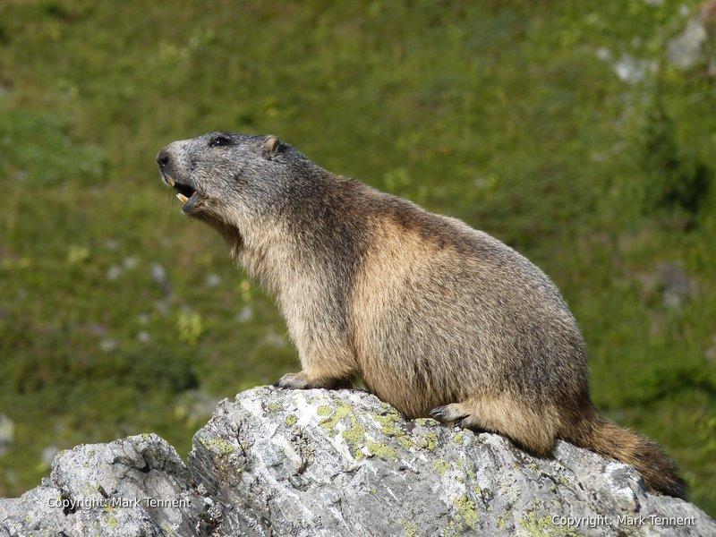
🐿️ Marmots – A favorite of hikers, these charming alpine rodents can be seen basking in the sun or whistling to one another.
Alpine Culture & Traditional Cheese Making
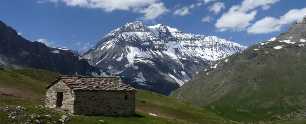
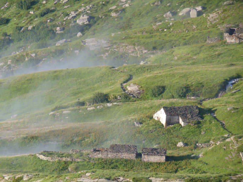
The Vanoise landscape has been shaped by centuries of traditional alpine farming. Scattered across the mountains, you’ll find historic stone chalets with slate roofs, blending seamlessly into the scenery.
During the summer months, herds of Tarine cows graze on the high-altitude pastures. These cows produce the rich milk used for the famous Beaufort cheese. If we arrive at the right moment, you’ll have the chance to watch cheese being made over an open wood fire at a local mountain farm—a true taste of Alpine tradition.
Ready for an unforgettable alpine adventure?
Join us for this incredible 6-day trek through the Vanoise Mountains, where breathtaking landscapes, authentic mountain culture, and unforgettable wildlife encounters await.
📍 Book your spot today!
Tour Map
The tour describes a clockwise route starting and finishing at Pralognan-la-Vanoise.
Pralognan-la-Vanoise, Savoie, FR
Day 1 – Pralognan to the Col de la Vanoise
A Scenic Ascent to the Col de la Vanoise
Today’s hike is a gentle ascent to the Col de la Vanoise (2,516 m), following an ancient trading route. Known as the “Route du Sel et de la Fromage,” this historic path once carried salt and cheese through the mountains.
After leaving the hotel, we walk through Pralognan-la-Vanoise, passing charming old stone houses before our climb begins. To our right, the Cascade de la Fraîche thunders between steep rocky walls, creating a dramatic spectacle. As the sun rises higher, the pine woods warm, filling the air with the rich scent of resin.
A short while later, we reach the Barmettes, where we cross a rushing mountain stream. This marks our entry into the heart of the Vanoise National Park. From here, the path is bordered by low, dry-stone walls, guiding us deeper into the mountains. To our right, the Aiguille de la Vanoise rises sharply, resembling a shark’s fin piercing the sky.
Stepping stones across the Lac des Vaches
Soon, we arrive at Lac des Vaches, where shallow waters reflect the towering peaks around us. Here, a set of stepping stones leads us across, making this an idyllic picnic spot. It’s the perfect place to enjoy fresh bread, local cheese, and cured meats, all while taking in the breathtaking views.
As we climb higher, the landscape changes. We pass glacial moraines, reminders of the mighty glaciers that once shaped this valley. Below the towering Grande Casse, we walk alongside Lac Long, gradually approaching the Col de la Vanoise. Finally, we arrive at the col, where the Refuge Félix Faure, named after France’s 7th president, welcomes us.
The col itself offers a stunning panoramic view, making it an ideal spot to pause and soak in the scenery. For those with energy left, a short exploration around the col may reveal ibex, chamois, or even edelweiss, the iconic flower of the Alps.
Time: c. 4 hrs Ascent: 1100m
D2 – Col de la Vanoise – Refuge de l’Arpont.
In the soft glow of the early morning light, we begin our gentle descent past a series of small, tranquil lakes. To our left, meanwhile, immense scree slopes rise dramatically toward the Grande Casse, while we pass the shimmering waters of Lac Bond and Lac du Col de la Vanoise. Further along, the Pointe de la Rechasse marks the eastern edge of the Glacier de la Vanoise, serving as a striking reminder of the high alpine environment.
Ahead, the landscape opens to the entrance of the Vallée de la Leisse and the Vallon de la Rocheure. As the trail steepens, we pass the remains of an ancient fortification, a silent sentinel at this once-strategic crossing. Stone-carved steps, worn smooth by time, lead us to a junction in the path.
Walking below the Glacier de la Vanoise
Traversing the rocky hillside at over 2,300 meters, we arrive at the Lacs des Lozieres, where the landscape shifts dramatically. The moraines of the Glacier du Pelve introduce a rugged contrast, and we carefully cross a rushing torrent emerging from its icy snout.
Above us, the Dôme de Chasseforêt (3,586 m) towers over the valley, while below, a deep-cut gorge winds toward Termignon in the Maurienne Valley. Rounding a final bend in the trail, we catch our first glimpse of the Refuge de l’Arpont (2,309 m), where a warm welcome from the guardian, awaits.
Time: 5 hrs Ascent: 550m – Descent 750m.
D3 – Refuge de l’Arpont – Refuge de la Dent Parrachee.
Today’s journey is dominated by the imposing La Dent Parrachée (3,697 m), its rugged slopes towering above us. Across the valley, we take in sweeping views of the Haute Maurienne and the distant Italian frontier. In summer, the Col du Mont Cenis serves as a historic crossing into Italy, leading to the town of Susa.
As we traverse the flanks of La Dent Parrachée, we pass centuries-old shepherds’ huts, reminders of a way of life still alive in these mountains. Large flocks of sheep, watched over by their shepherds, graze on the alpine pastures throughout the summer before making their descent to warmer valleys in late autumn.
A small plateau gives way to a switchback descent, weaving through scattered pine trees. Soon, we arrive above the village of Aussois, where two lakes, Lac d’Amont and Lac d’Aval, shimmer in the valley below.
Several mountain refuges dot this area, but my favorite is the Refuge de la Dent Parrachée (2,517 m). Here, Franck, the guardian, runs the hut with warmth and efficiency, assisted by Kapitan, a Nepali Sherpa. A hub for mountaineers preparing to tackle the surrounding peaks and glaciers, the refuge offers a stunning terrace—the perfect spot to unwind with a pre-dinner drink, soaking in the breathtaking mountain panorama.
Time: 7 hrs. Ascent: 1200m – Descent 1000m.
D4 – Refuge de la Dent Parrachee – Refuge de l’Orgere
Today offers a choice of routes: the “normal” route via the Col du Barbier or the high route over the Col de la Masse (2,923 m). Whichever path we take, the scenery remains spectacular.
Descending from the “eagle’s nest” of the Dent Parrachée, we soon reach a fork in the trail, just above the Plan d’Amont reservoir. Following the Col du Barbier route, we join the GR5, the famous long-distance trail that stretches all the way to the Mediterranean.
For the first time since leaving Pralognan, we dip below the tree line, where the landscape softens. The fresh scent of pine resin fills the air, and among the branches, we might spot a Casse-noix moucheté (spotted nutcracker) darting between trees, feeding on pine nuts.
At 1,860 meters, this marks the lowest point of our trek before the final day’s walk back to Pralognan (1,418 m).
Time: 5 hrs Ascent: 300m – Descent 600m
D5 – Refuge de l’Aiguille Doran – col de Chaviere – Refuge Peclet-Polset.
Crossing the Col de Chavière: A Day of Alpine Beauty
Turning our backs to the Maurienne Valley, we begin our ascent into the high mountains. Today offers two route options—one passing through the hamlet of Polset, the other leading through the Vallée de l’Orgère and its historic mountain refuge.
If we take the Orgère route, we walk through flower-filled hayfields, a nod to the valley’s past when oats were cultivated in this sheltered alpine bowl. Here, we cross the only paved road we’ll encounter until the final day of our trek, before heading uphill on a zigzagging path through open woodlands.
As we climb above the treeline, the trail follows a gentle ascent. Above us, the spiky summit of Aiguille Doran (3,041 m) dominates the skyline.
The terrain flattens among scattered glacial boulders. Here, we can take a short detour to Lac de la Partie, a perfect picnic spot. For the adventurous, a quick (and freezing!) dip in its crystal-clear waters is an option.
Crossing the Col de Chaviere
Ahead, the Col de Chavière marks the watershed between valleys. Despite its altitude, the col is easily reached, though lingering snowfields may still be present. On clear days, the view stretches all the way to Mont Blanc.
A short but steep descent over loose terrain leads us into a landscape of undulating glacial moraines, where we may step off the path in search of ibex, often found resting in their favorite rocky hideouts.
Our destination is the Refuge Péclet-Polset, a large, modern mountain hut rebuilt after a fire destroyed the original. Before settling in, we can take a short excursion to visit the turquoise waters of Lac Blanc, nestled beneath the Col du Soufre and the towering Dôme de Polset (3,328 m)—a spectacular way to end the day’s journey.
Time: 6 hrs. Ascent: 1080m Descent: 450m
D6 – Refuge Peclet Polset to Pralognan la Vanoise.
A Gentle Descent Back to Pralognan
Our final day’s walk is a long, gentle descent alongside the rushing waters of the Doran, winding through lush alpine pastures where herds of cows graze peacefully. Along the way, we pass a working farm, offering a chance to see traditional cheesemaking in action—a perfect glimpse into the region’s pastoral heritage.
Continuing downhill, we reach the luxurious Refuge du Roc de la Pêche, an inviting mountain lodge complete with a jacuzzi. Here, we have the option to take a detour toward the Cirque des Nants, a scenic side valley, or simply follow the main trail along the valley floor.
Descending further, we arrive at the hamlet of Prioux, where a small mountain road, closed in winter, marks our transition back toward civilization. Crossing to the opposite side of the valley, we follow a forest path through fragrant pine woods, eventually emerging right in the heart of Pralognan.
Back at the Hotel Grand Bec, we are warmly welcomed once more. Now it’s time to unwind—perhaps with a refreshing swim in the pool or a well-earned drink on the terrace, reflecting on the unforgettable journey through the Vanoise mountains.
Time: 5 hrs Descent 500m.
Baggage Transfer
Due to the nature of this tour baggage transfer is not possible. Baggage not needed on the tour can be left at Pralognan until you return.
Group size
Individual 1:1 guiding
Maximum group size 8
Duration
6 days walking – 7 nights
(Shorter tours and longer tours can be arranged).
Meals
Dinner in the refuges is a set menu. It is typically soup, a main course and dessert.
Packed lunches: these can be reserved in advance. There are no shops or other refuges where you can buy food.
What’s included:
What’s NOT included:
Fees
The price indicated is for the group.
1 – 2 people: Euro 1500
3 – 5 people: Euro 1800
6 – 8 people: Euro 2400